Boletín Diario Oceanográfico (BDO)
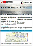 Boletín informativo que reporta la evolución de la Temperatura Superficial del Mar (TSM) y sus anomalías a nivel local y regional. El boletín se sustenta en la información in situ de los laboratorios costeros del IMARPE así como en información satelital de agencias internacionales.
Atención:
A partir del 11 de febrero de 2016, la información limnológica del Lago Titicaca se presenta en el Boletín Diario de la Temperatura Superficial del Agua en el Lago Titicaca documento disponible en esta sección.
A partir del
04 de mayo de 2017, el análisis de la temperatura superficial del mar y sus anomalías ha migrado del producto Radiómetro Avanzado de Muy Alta Resolución (AVHRR en inglés) al producto Temperatura Superficial del Mar y Análisis de Hielo Marino Operacional (OSTIA en inglés) del Servicio Meteorológico del Reino Unido. Esta información de alta resolución (0.054° lat/lon, ~5 km), disponible en el servicio https://podaac.jpl.nasa.gov/dataset/OSTIA-UKMO-L4-GLOB-v2.0, es el resultado de la combinación de los datos de cinco sensores satelitales y de información in situ registrada mediante boyas fijas y a la deriva, resultando un producto mejorado y con campos de temperatura adecuadamente suavizados.
- Boletines [Aquí]
Oceanographic Daily Bulletin (BDO)
The BDO reports on the evolution of Sea Surface Temperature (SST) and its anomalies at a local and at a regional scale. The bulletin is based on on-site information at the IMARPE Pier Shore Stations as well as satellite information from international agencies.
Atención:
As of February 11th, 2016, the limnological information of Lake Titicaca is presented in the Daily Bulletin of Surface Water temperature in Lake Titicaca document available in this section.
As of May 4th, 2017, the analysis of SST and its anomalies migrated from the High Resolution Advanced Radiometer (AVHRR) to the Sea Surface Temperature and Operational Sea Ice Analysis (OSTIA) of the United Kingdom Meteorological Service. This high resolution information (0.054 ° lat / lon, ~ 5 km), available in the ftp://podaac-ftp.jpl.nasa.gov/alldata/ghrsst/data/l4/glob/ukmo/ostia/service, is the result of the combination of data from five satellite sensors and in situ information from fixed and drifting buoys, resulting in an improved product and with temperature fields that are suitably smoothed.
- Bulletins [Here]
- INFORMES QUE SUSTENTAN RESOLUCIONES MINISTERIALES
- REPORTE DE LA ACTIVIDAD
PESQUERA - SERVICIO DE INFORMACIÓN OCEANOGRÁFICA DEL FENÓMENO EL NIÑO
- GUÍAS DE IDENTIFICACIÓN - ESPECIES MARINAS
- COMISIÓN MULTISECTORIAL ESTUDIO NACIONAL FENÓMENO EL NIÑO
- PROG. INT. CONSERVACIÓN DE DELFINES (APICD)
- IMÁGENES SATELITALES
- REPOSITORIO DIGITAL
- SERVICIOS
- MACROALGAS
- PLAN DE ACCIÓN - TIBURÓN
- VARAMIENTO - MORTANDAD DE FAUNA MARINA
- FLORACIONES ALGALES NOCIVAS
- BANCO DE GERMOPLASMA ORGANISMOS ACUÁTCOS
- CONVOCATORIA
- KOPE–LAR
 ATENCIÓN AL CIUDADANO
 SISTEMA DE CONTROL INTERNO
 RENDICIÓN DE CUENTAS (VIÁTICOS Y ENCARGOS)
 GALERÍA DE FOTOS
 GALERÍA DE VIDEOS
 BUSCAR


Todos los Derechos Reservados N° 2013. Instituto del Mar del Perú IMARPE
Esquina Gamarra y General Valle S/N Chucuito Callao
Horario de atención: 08:00 - 16:30 Hrs.
Telf: (051)208-8650